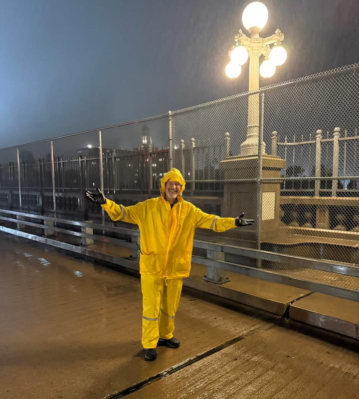
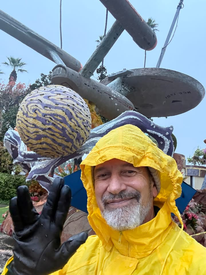
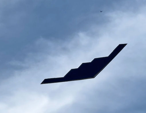
We meet our tour leaders, Brian and Chantal Cravens, for the official club group photo at 6:00 AM on the West end of the Colorado Blvd Bridge. - aka Suicide Bridge - at the junction with Linda Vista (Old Pasadena/Rose Bowl sign). Wear your Foothill Flyers sweat shirt or shirt on top with layers under if cold. Bring a camera. We will jog and walk by all the Rose Parade floats on Orange Grove going down the East side of Orange Grove with a short detour east on Del Mar to see the bands and special entries - see the map on right. Then you can either come back on the West side of the floats or if you have had enough and want to run, turn right (West) and come back up on Arroyo or even down in the wash back to the East end of the Colorado Blvd. bridge for the flyover at 8:06 AM. The B2 also flies over the Rose Bowl and departs East bound over Arcadia about 2:05pm.
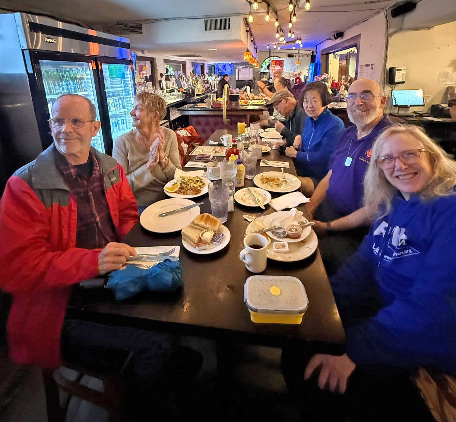
Following the bridge flyover, back to your car and on to the Nano Cafe for breakfast arriving about 8:30am - South side of Sierra Madre Blvd. east of Michillinda. Take the Michilinda off ramp from the 210 east bound, and go north to Sierra Madre Blvd. Turn right and go 3 blocks to Lima. Look for the Cafe at 322 W. Sierra Madre Blvd - map. The Float Run is optional depending on the weather, but breakfast at Nano Cafe is rain or shine.
Run Directions: Despite all the traffic trying to get to the parade route, it is actually easy to get to the run start and park - download map directions. Get off the 134 freeway at San Rafael and on the south side of the freeway, turn right on Colorado Blvd. Turn left on San Rafael Ave and find a place to park on the street.
If trapped in Pasadena south of Colorado, east of Orange Grove and west of Sierra Madre Blvd, or cant get to the 210 due to street closures, try getting to South Pasadena. Take Mission west, right on Grand which will merge (left) with Arroyo blvd. Turn left and go over the La Loma Rd bridge. Then right on San Rafael - see Google map.
The Run: Total distance one way from the corner of Colorado and San Rafael to the end of the floats at Orange Grove and Bellefontaine is 1.7 miles. After taking the group photo at 6:00am we go across the Colorado bridge, bare right at the east end and take Grand Ave down to Maylin to get to Orange Grove and the floats. The last float is usually at Bellefontaine and turn around time is no later than 7:05am. You can run West to Arroyo Blvd and find your way back to the bridge or walk back up the West side of the floats until it gets too crowded, turn left and back up Grand Ave and then stop at the east end of the bridge for the flyover at 8:06am.
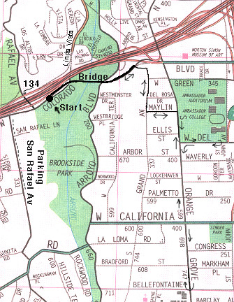
Click on the map above to download and print a copy to take with you to the run.