Foothill Flyers Mountain Trail Runs
Last update Dec 25, 2007
Bailey Canyon Trail
 This is more of an adventure hike than a run to see the remains of the Rubio Pavillion - start of the Incline Railway to Echo Mountain - and some water falls. For those interested in the history of the Mt. Lowe area check out the old post cards, Mt. Lowe Preservation Society, Mt. Lowe Railway Historical Committee and Rubio Canyon web sites. Check the Altadena Weather Cam before leaving home.
Some time in the future, the Altadena Crest Trail will have the gap between Rubio Canyon and Sam Merrill Trail completed. But for now, we start on the Sam Merrill Trail but turn down the valley to take the street route to Rubio Canyon.
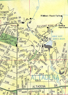
The start is from the very top of Lake Av in Pasadena. From the 210 take the Lake Av off ramp and go north toward the mountains til you cant go any farther (at Loma Alta Dr,). Park on Lake Av. or Loma Alta. Thomas Map 536-A3-4. If you plan to run this trail on the weekend, parking can be sparce and if the case, consider parking at Farnsworth Park in the SE corner at Concha St.
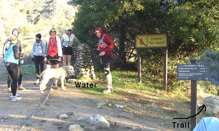
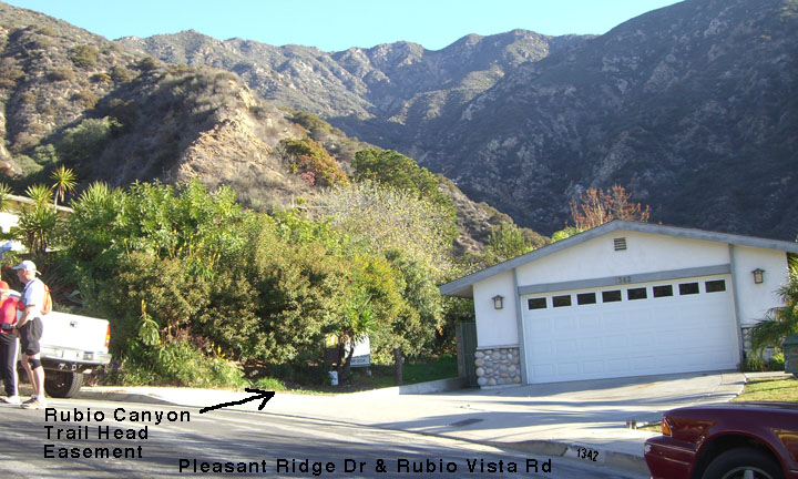
Walk north up Lake Ave to the Cobb Estate entance at the NE corner of Lake and Loma Alta. Run east about 100 yards along the fence until you come to the Sam Merrill trail sign and a drinking fountain. From there you will go NE down into a little valley. Turn hard right about 10 ft before the first debris dam and go down the ravine. You will pass by some houses but keep the stream bed and chain link fence on your right and it will take you down to Rubio Canyon Rd. Turn left and one block east, left again up Rubio Crest Dr. Take a right on the first street which is Rubio Vista Dr. At the top of this street is the Rubio Canyon Trail easement on the north side of the home at 1342 Rubio Vista Dr.
 From the Rubio Canyon trail head, I suggest downloading and printing out the fine map from the Altadena Trails web site.
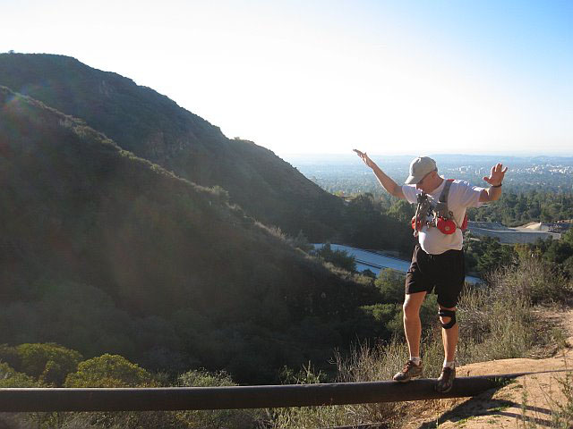 For the next 1500 ft the trail is a nice single track that is quite runable, but watch for a few wash out areas that have some good foot bridges and some in need of repair. No, you don't have to tightrope across the pipe.
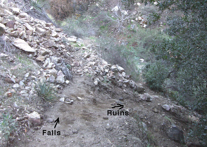
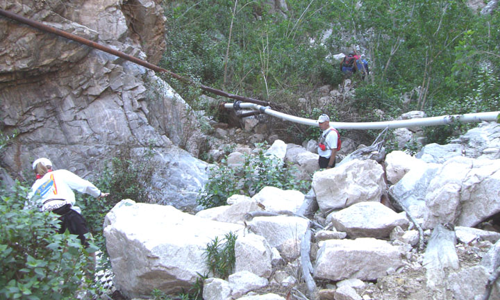
Just before you reach the Rubio Pavillion ruins there is a split in the trail. Go right down hill if you want to explore the concrete footings - right photo - or stay straight and follow along the pipe to a rough section past the ruins that goes down to the stream bed.
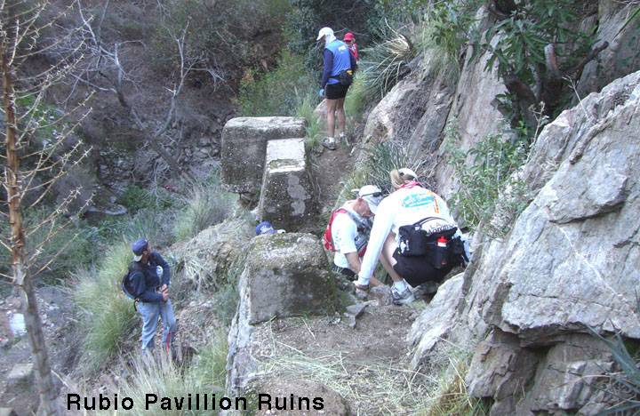
From the Pavillion between 1893 to 1936, passengers boarded the Incline Railway for the 3000 ft trip up to the Echo Mountain hotel landing some1250 ft above. There was also a network of wooden walkways and bridges so people could enjoy the falls.
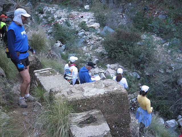
You can look, but there is no easy way directly down from the concrete pilings into the stream bed.
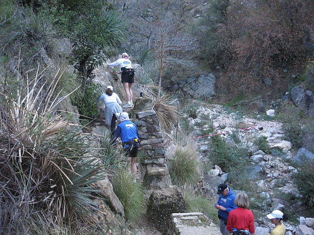
However, you can climb up and out the north side to the trail leading down into the stream bed.

Easiest way is to follow the metal pipe across and above the pilings.
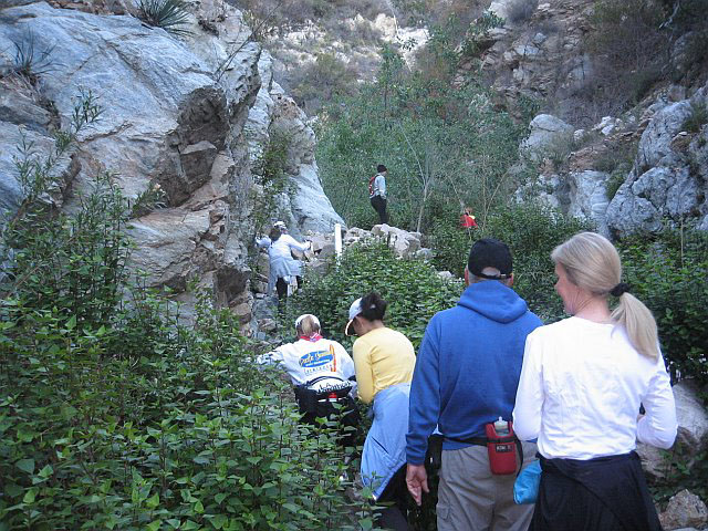
Once in the streambed it is rock hopping or finding where everyone else went for about 400 yards until your reach Moss Grotto/Ribbon Rock Falls.
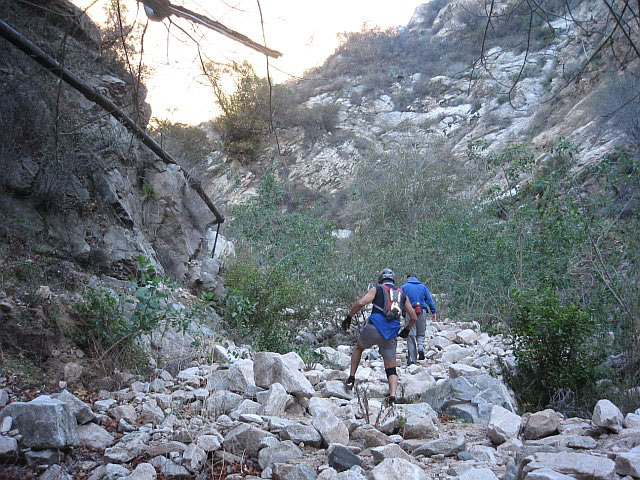
It is not really as bad as the photos might lead you to believe.
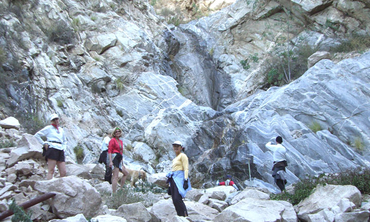
The two falls did not have much water flowing over the rocks when we were there in December 2007, but the best time may be in March or April a few days after a good rain. Depending on trail conditions, you can try the Thalehaha Overlook trail which continues off to the east to get a look at another falls higher up the canyon.
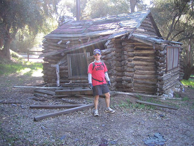
You can come back the way you came or, almost to the trail head, and if it is not too grown over, there is a trail that goes back down into the canyon and then follows the stream bed on the east side on down to pavement that comes out on Rubio Canyon Rd. Just before coming out on Rubio Canyon Rd is the remains of a log cabin.
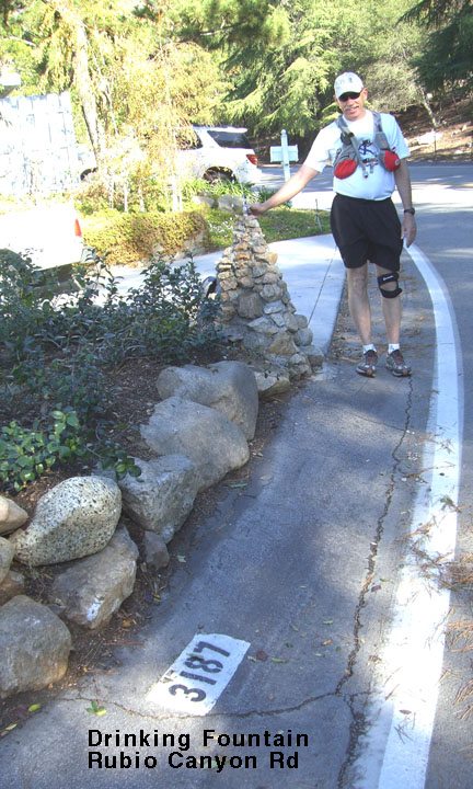 Go west on Rubio Canyon Road and there is a drinking fountain at 3187. Turn right on Mount Curve then left on Concha St to get back to the Farnsworth Park Parking lot.
Back to:
Run Routes & Maps
Echo Mountain Trail run
Foothill Flyers home page
Weekend Warriors