Foothill Flyers Mountain Trail Runs
Last update August 27, 2021
Return to: Trail Routes & Maps - Foothill Flyers - Weekend Warriors
El Prieto and Gabrielino Western Trail
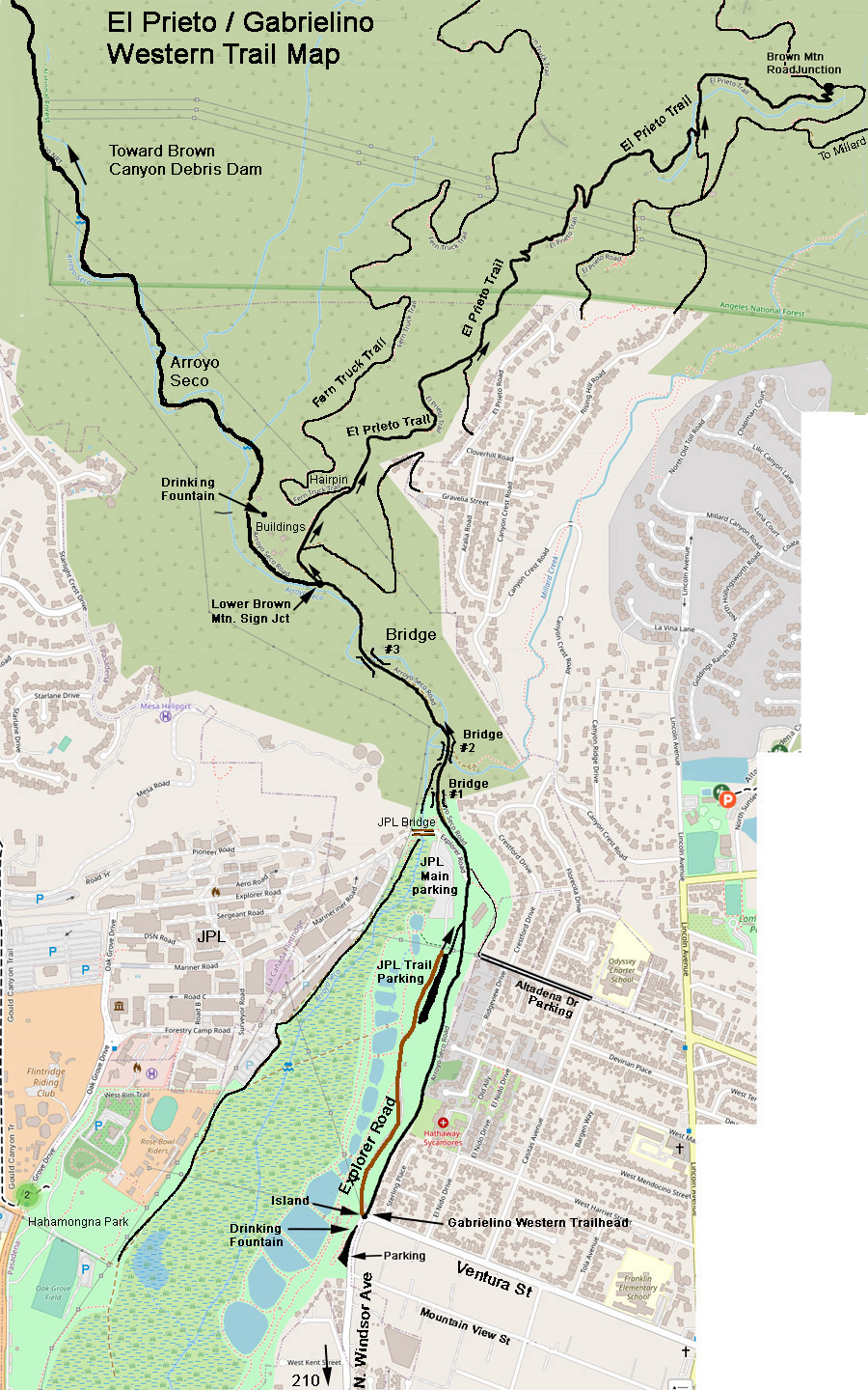 El Prieto trail to the Lower Brown Mountain Road junction is 6.6 miles out and back from the Gabrielino Trail Western Trailhead at the corner of Windsor and Ventura in Altadena or 5.8 from the JPL Trail parking area. Elevation gain is 912 ft. The El Prieto Trail is an interesting single track in a canyon that is also the final section of the Angeles Crest 100 Mile Trail Race. This trail is best run on a week day as it is very popular with mountain bikers on the weekends. Most mountain bikers will have bells to warn you when they are coming and will give you the right of way, but keep your awareness up for those that don't.
To get to the El Prieto Trail, take the dirt road on the right of the Lower Brown Mountain sign. Stay on it until you come to the El Prieto Trail single track at a left hairpin turn about 1000 ft past the junction. It is about 2 more miles to the Brown Mountain road junction all on single track along a stream. See the Brown Mountain Loops web page for more trail options in this area.
The Gabrielino Western Trail starts at the corner of Windsor and Ventura on Arroyo Seco Road. Arroyo Seco Road is just to the right of Explorer Road which goes down into the JPL East parking lot. If you start from the JPL Trail parking lot, it will cut off about .4 miles of asphalt. After crossing over the 3rd bridge, in about 800 ft, you will come to the Lower Brown Mountain sign and some buildings at a junction. You can take the road to the El Prieto Trail to the right or continue straight or left up the Gabrielino Trail toward the Brown Canyon Debris Dam.
The Brown Canyon Debris Dam turn around is up the Arroyo Seco on the Gabrieleno Trail. It is a nice walk/jog of about 8.5 miles round trip or turn back as you wish. The Station Fire totally destroyed the bridges and what was once a fire road is now a single track trail. It is a lot more runnable than some that we do and the shade and 8 water crossings make it ideal for those hot summer days. Most crossings are dry this time of year or are easily rock hopable. There is an off shoot trail to the left after the Paul Little camp ground that will take you to the base of the dam. If you stay on the trail to the right it climbs up over dam and goes to the Oakwilde camp ground.
To get to the JPL or Windsor trail parking lots and Gabrielino Trail Western Trail, take the Windsor Ave off ramp from the 210 Freeway and go North about a mile - see map. You will see the parking lot on the left just before Ventura St. If the lot is full, you can try parking on Mountain View St. or if the JPL lot is open, take the road on the left around the island from the corner of Windsor and Ventura. In the JPL lot, park just before the overhead power lines, do not go into the main JPL parking area South of the JPL bridge. There is a dirt trail going up to the Gabrielino Trail from the Trail Parking area indicated on the map above. There are 2 other alternative starting points to get to thetheseTrails. Hahamongna Park and the End of Altadena Dr.

View North on Windsor passing Mountain View approaching Gabrielino Western Trailhead parking lot on the left. JPL can be seen across the Arroyo from the lot. There is a drinking fountain at the North end of the Gabrielino Western Trailhead parking lot. If the JPL parking lot is open, you can park there instead and save .4 miles of asphalt.
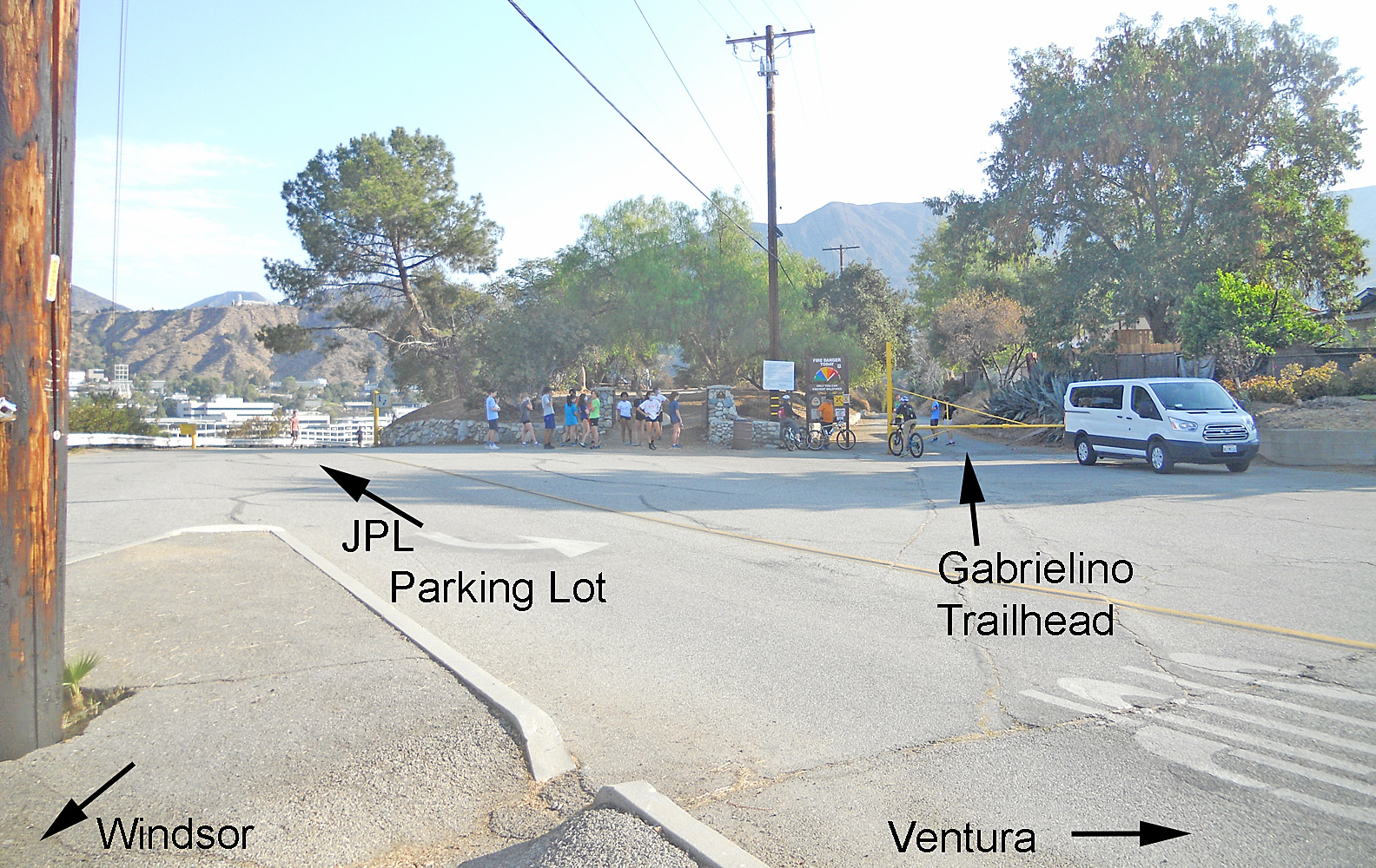
As you come to the end of Windsor, there is an island with utility poles at the corner with Ventura. This view is from the island looking toward the Gabrielino Trailhead entrance on the right and the JPL Explorer road down on the left.
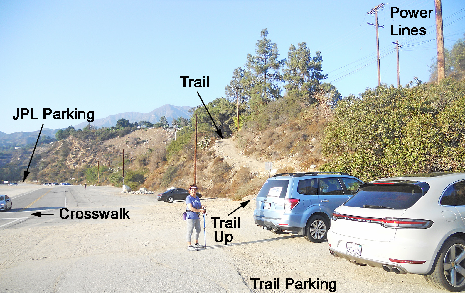
Trail parking area before the main JPL East parking lot under the power lines. Easier trail access vs. the main parking at the JPL bridge.
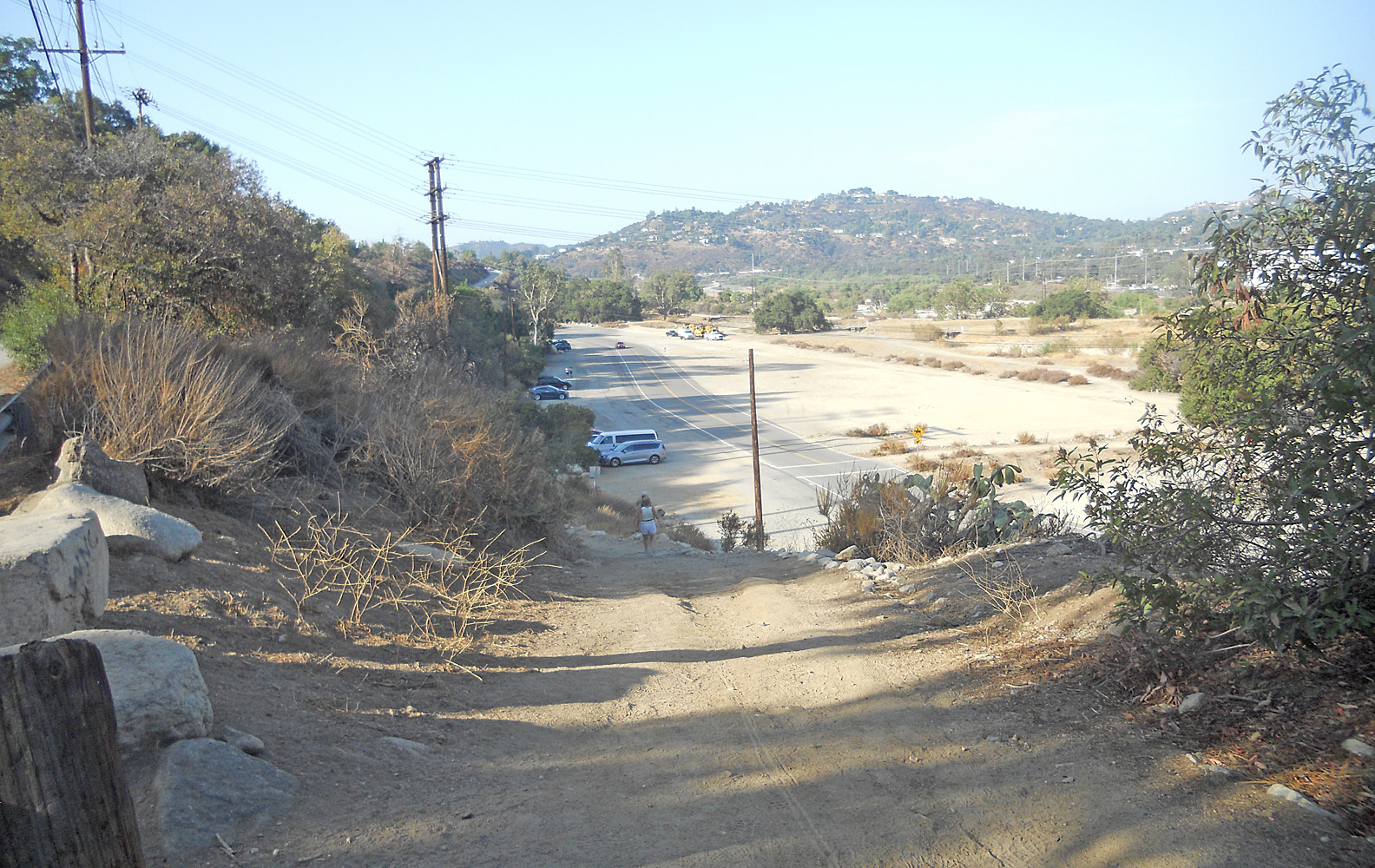
Looking down the dirt path up from the JPL parking lot at the Gabrielino Western trail junction. Note the cars parked in the area just before the power lines, crosswalk and brush across the dirt area.
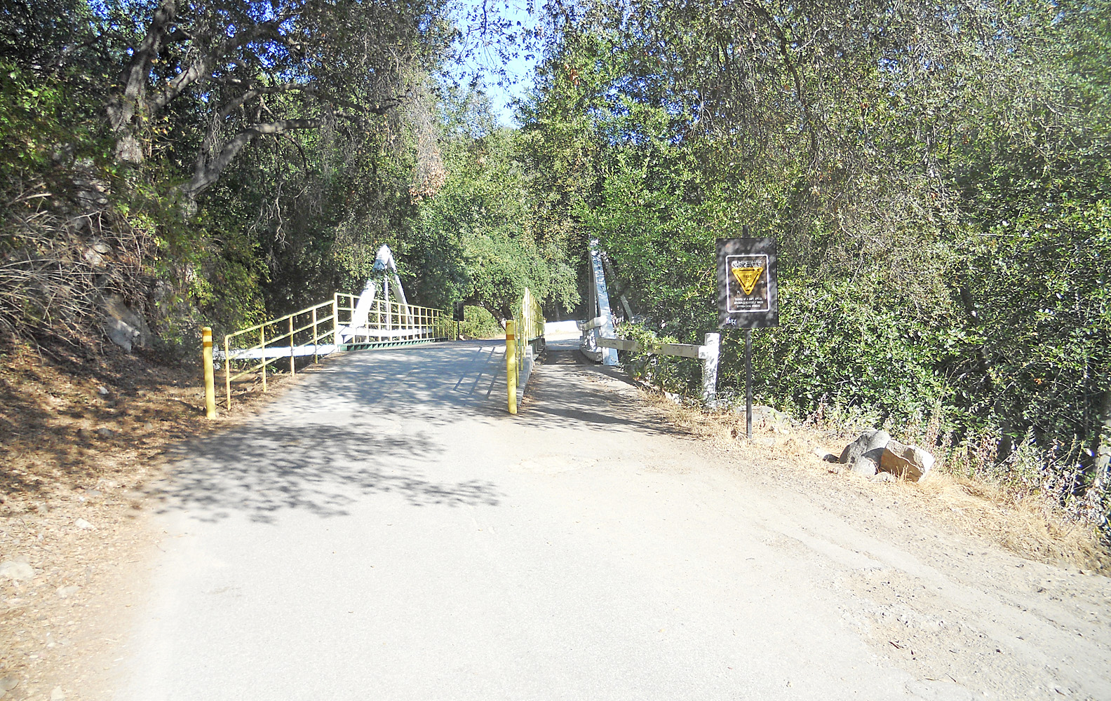
Bridge #1 on the Gabrielino Western trail just after passing the JPL bridge. The JPL bridge goes from the parking lot across the stream into "The Lab".
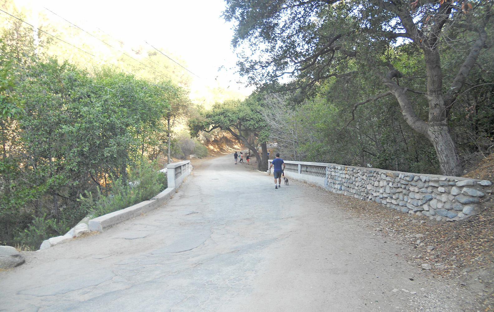
Bridge #2, an old stone structure that crosses over the Arroyo Seco stream. Some single tracks junction between bridge #1 and #2 if you come from the West side of the Arroyo from Hahamongna Park and go under the JPL bridge.
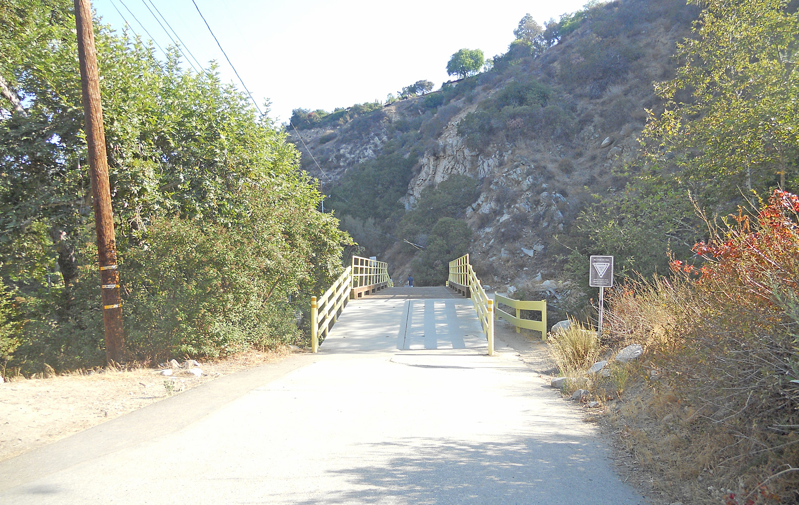
Bridge #3 is a metal structure built over the old original wooden one. The stream crosses back over to the West of the Trail.
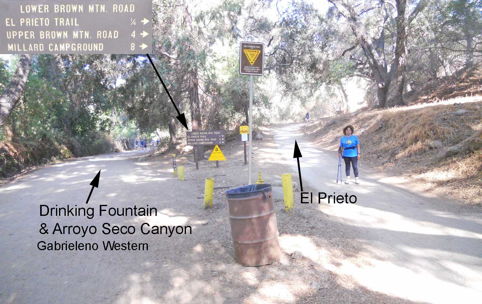
When you get to the Lower Brown Mountain Sign junction, going to the right will take you to the El Prieto Trail Head. The Upper Brown Mountain and Millard distances are if you miss the El Prieto Trail junction and go the long way around up the Fern Truck Trail. If you take the road up from the left side of the sign, in about 100 yards is a drinking fountain and the trail continues up the Arroyo Seco to the Brown Canyon Debris Dam, Oakwild and Switzers Camp. See the Brown Mountain Loops web page.
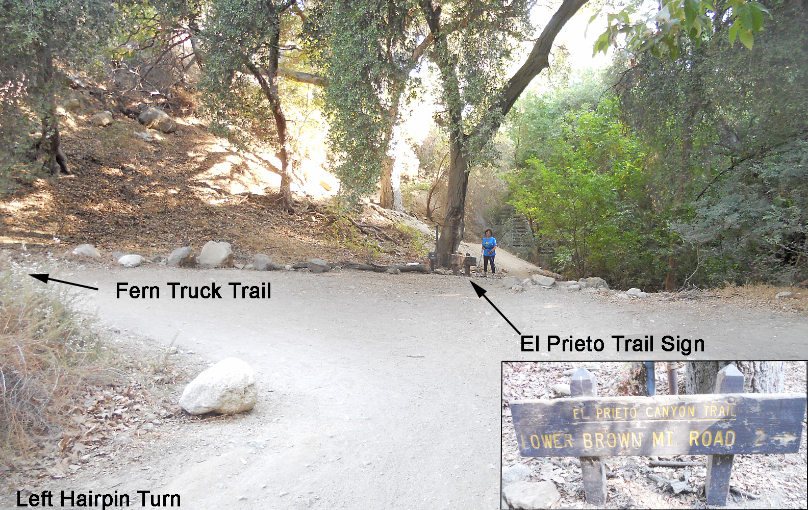
Go straight ahead to the El Prieto Canyon Trail sign just as you come to a sharp left hairpin turn. From here it is all single track up the canyon to the junction with Brown Mountain Road.
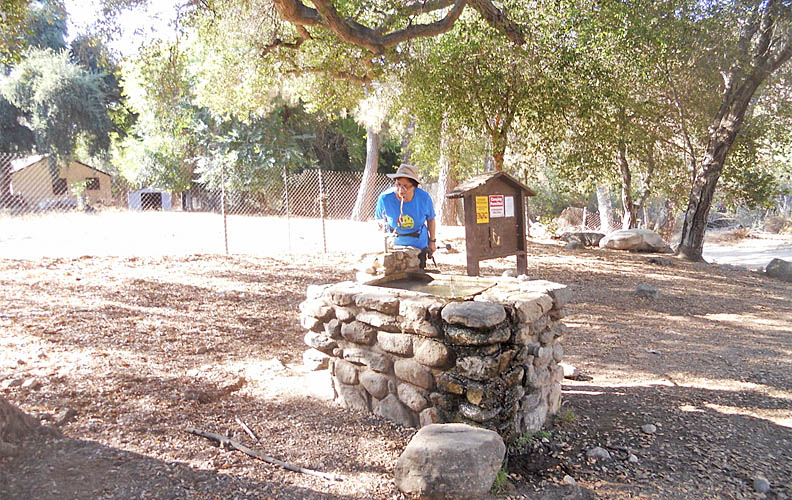
If you are going instead to go up the Gabrielino Western Trail to the left of the Lower Brown Mountain sign, after about 100 yards look for a drinking fountain on the right.