Foothill Flyers Mountain Trail Runs
Last update Aug. 31, 2022
Gabrielino Western Trail Run
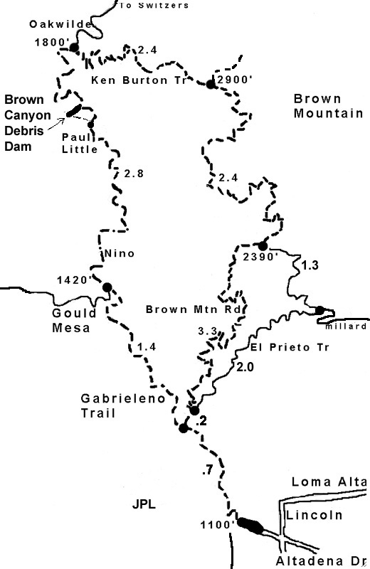 If used for one of the last Wednesday of the month club trail runs, we run from the JPL East parking lot up the Arroyo on the Gabrieleno Western Trail out for 40 minutes and back for 35 minutes. However, on the weekends, it is a nice walk/jog out and back of about 8.5 miles round trip from the JPL Eastern parking lot in Pasadena. The Station Fire totally destroyed the bridges and what was once a fire road is now a single track trail. Having said all that, this now might become one of the Weekend Warriors favorite trails. It is a lot more runnable than some that we do and the shade and water crossings make it ideal for those hot summer days. There is an off shoot trail to the left after the Paul Little camp ground that will take you to the base of the dam. If you stay on the trail to the right it climbs up over dam and goes to the Oakwilde camp ground. For the walkers or those that want to go shorter you can turn around at the Gould Mesa trail junction for about 4.2 miles round trip.
Directions: From the 210 in Pasadena, get off on Windsor (East side of the Arroyo and Devils Gate Dam) and go North for 1 mile to the intersection of Windsor and Ventura. Turn left around the island and take Explorer Road down into the Arroyo to the JPL East parking lot - Location: 34.200224, -118.165842 Park in the dirt lot under the power line just before the crosswalk. The Gabrielino Western trail is up a dirt trail from the the crosswalk. The Gabrielino Western Trail actually starts at the corner of Windsor and Ventura on Arroyo Seco Road.
Click on map to the right to enlarge and print out.
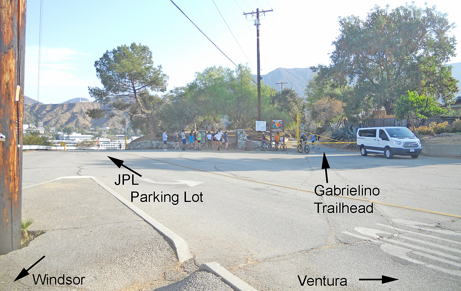
As you come to the end of Windsor, there is an island with utility poles at the corner with Ventura. This view is from the island looking toward the Gabrielino Trailhead entrance on the right and the JPL Explorer road down on the left.
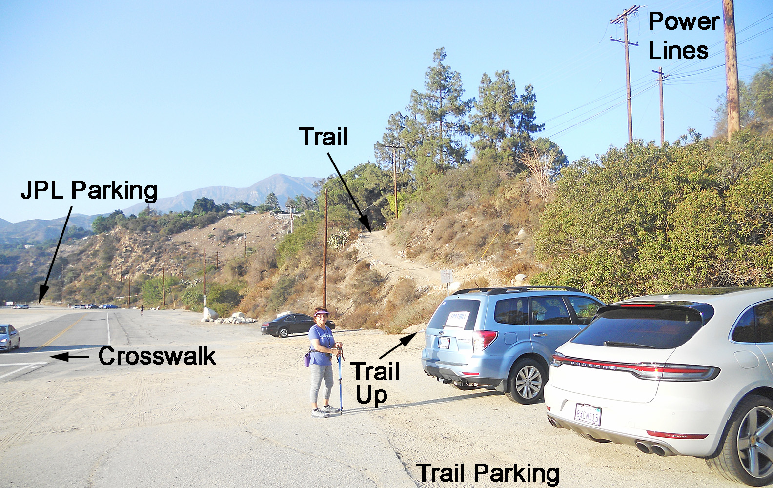
Trail parking area before the main JPL East parking lot under the power lines. Easier trail access vs. the main parking at the JPL bridge.
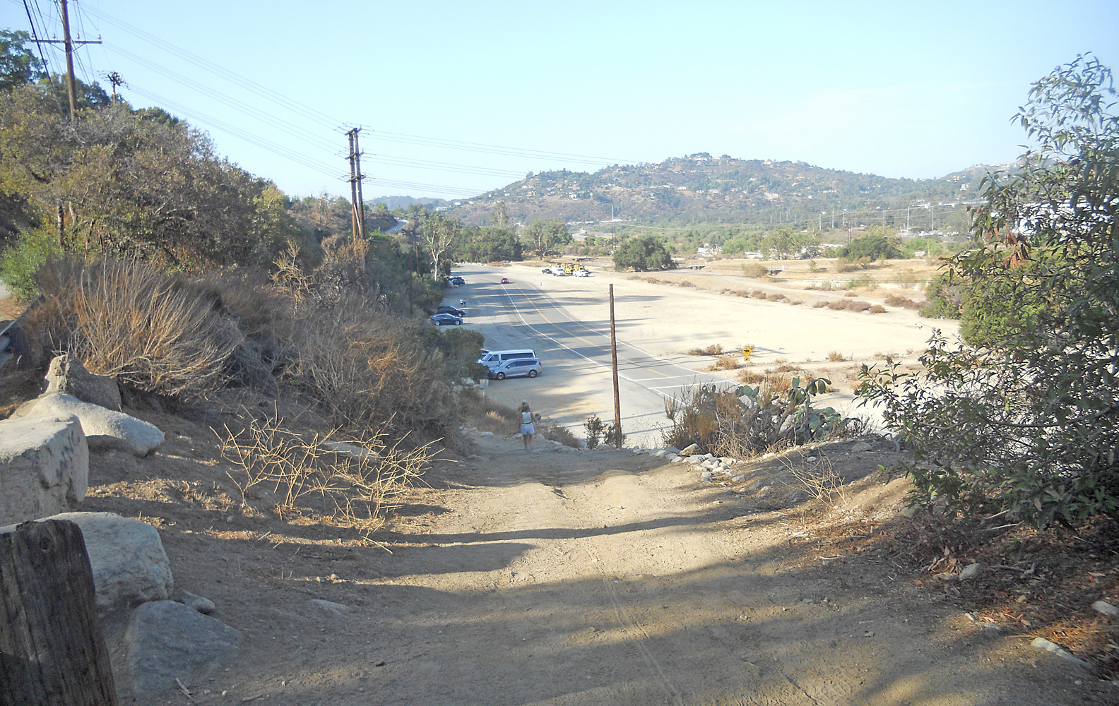
Looking down the dirt path up from the JPL parking lot at the Gabrielino Western trail junction. Note the cars parked in the area just before the power lines, crosswalk and brush across the dirt area.
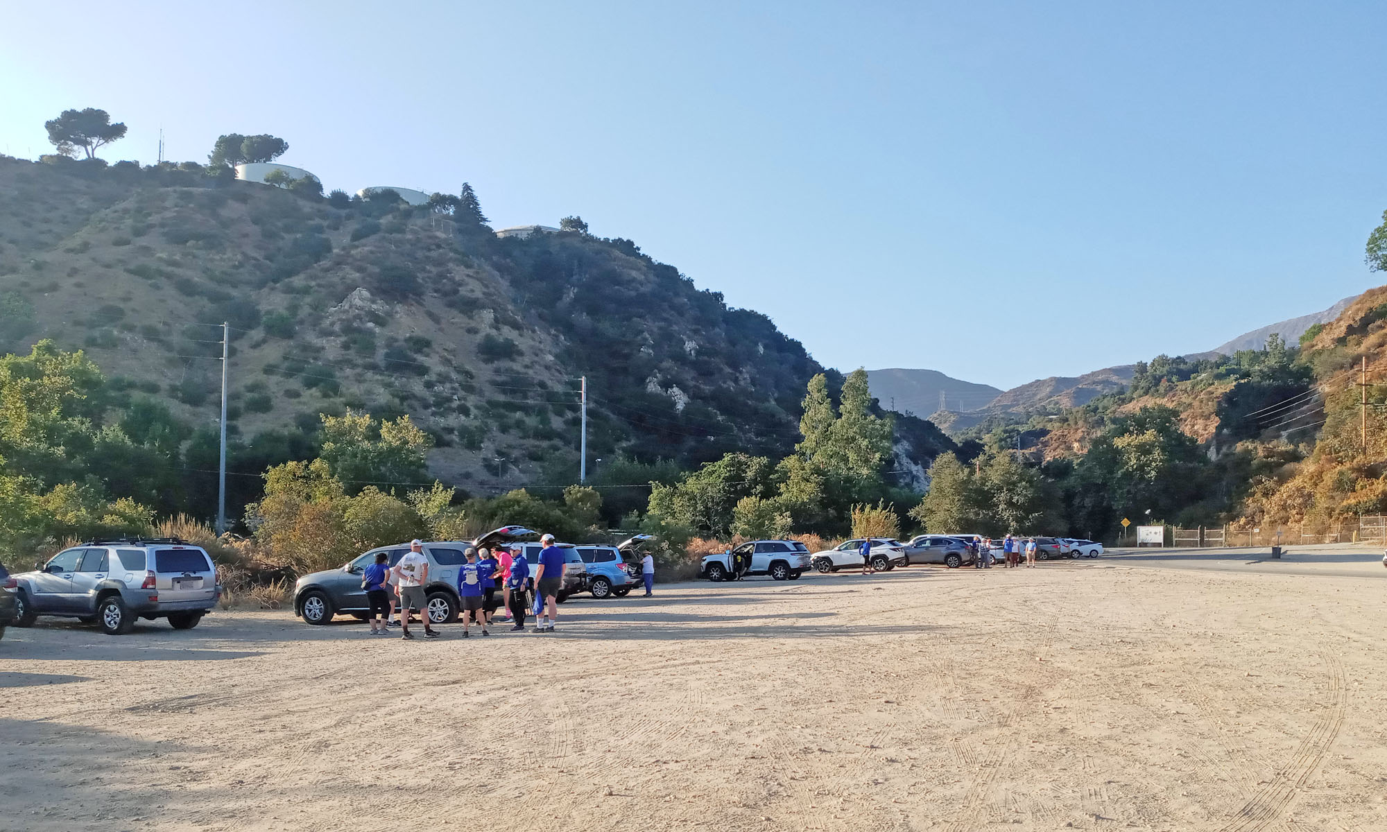
When it is hot, many park in the NW corner of the JPL parking lot to get some shade from some trees and bushes.
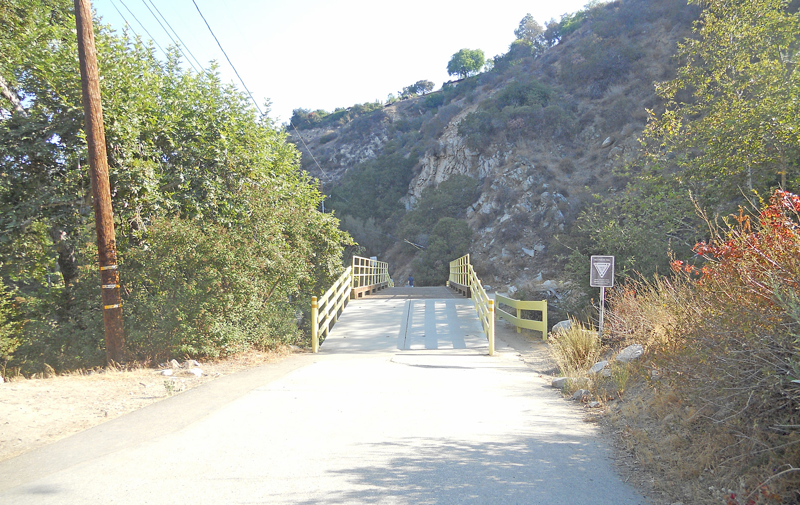
Bridge #1 on the Gabrielino Western trail just after passing the JPL bridge. The JPL bridge goes from the parking lot across the stream into "The Lab".
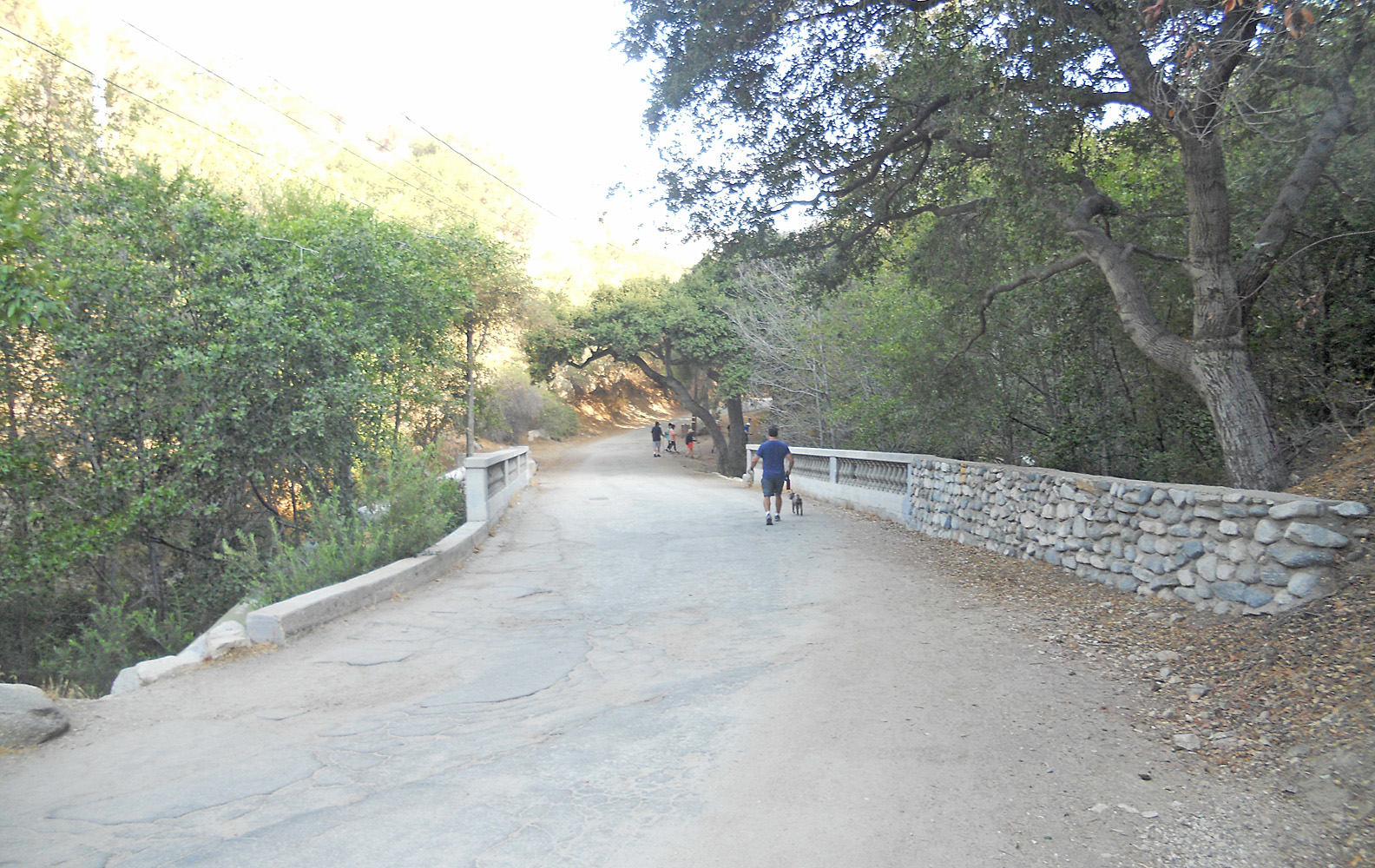
Bridge #2, an old stone structure that crosses over the Arroyo Seco stream. Some single tracks junction between bridge #1 and #2 if you come from the West side of the Arroyo from Hahamongna Park and go under the JPL bridge.
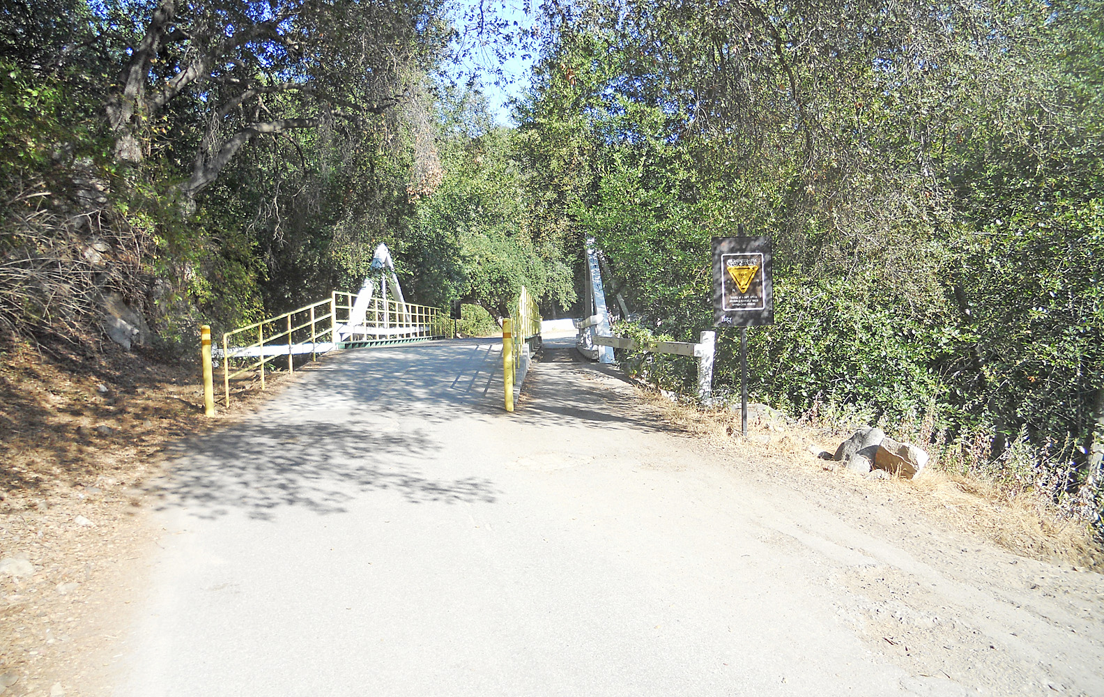
Bridge #3 is a metal structure built over the old original wooden one. The stream crosses back over to the West of the Trail.
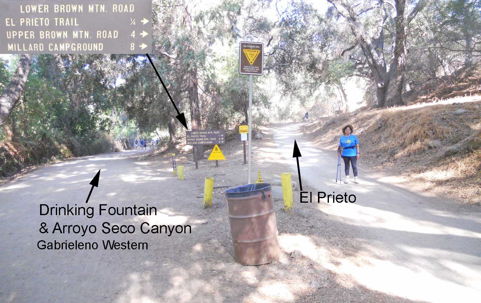
When you take the road up from the left side of the sign, in about 100 yards is a drinking fountain and the trail continues up the Arroyo Seco to the Brown Canyon Debris Dam, Oakwild and Switzers Camp. But if you go to the right it will take you to the El Prieto Trail Head. The Upper Brown Mountain and Millard distances are if you miss the El Prieto Trail junction and go the long way around up the Fern Truck Trail. See the Brown Mountain Loops web page.
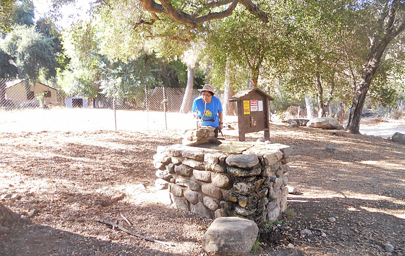
Going up the Arroyo Seco on the Gabrielino Western Trail to the left of the Lower Brown Mountain sign, after about 100 yards look for a drinking fountain on the right.
The domain of this page is Foothillflyers.org
Copyright ©2022 Tom O'Hara. All rights reserved.
Contact: webmaster at foothillflyers dot org